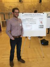
Justin Mohler and Kye Terrasi presented their research project Digital Humanities in the Language and Culture Classroom and Beyond at the 2017 Teaching and Learning Symposium at UW. Their poster presentation explored ways of integrating Digital Humanities technology such as ArcGIS into the classroom as a tool for students to access and perform research on the cultural, social and geographical makeup of a city through the mapping of data and analysis of the results.
Justin and Kye's research project focused on the connection between the geographic locations of Berlin's areas of diversity and the development of new industries, such as startups. Their research has led them to explore how this technology can be adapted for use in advanced German language or cultural studies courses, as a means to teach culture and history, or as a tool to interpret social, political and economic trends in contemporary societies. Precisely mapping different phenomena in urban spaces provides both humanities and STEM students with an instrument to visualize abstract concepts, as well as with new ways to analyze their research and collected data.
They believe that this technology could facilitate learning in the Department of Germanics' Urban Humanities courses through interactive and collaborative group projects. Working with ArcGIS would provide students with hands-on experience as they gather research, input data and critically engage with the mapped results.
Both Justin and Kye see ArcGIS technology as a tool to reach across disciplines and make the humanities more engaging and relevant to students from other fields. The technology’s applications can be easily adapted for use by diverse academic disciplines to help students process and interpret different data sets.

